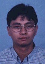
 |
Li
Junhua
Ph.D. Student Dept. of Geography McGill University Burnside Hall 805 Sherbrooke St. W. Montreal, QC, H3A 2K6 Canada e-mail: lijh@geog.mcgill.ca |
 |
Li
Junhua
Ph.D. Student Dept. of Geography McGill University Burnside Hall 805 Sherbrooke St. W. Montreal, QC, H3A 2K6 Canada e-mail: lijh@geog.mcgill.ca |
| Resume | Research Interests | Skill | Current Projects | Download |
|
I am born in Jinxian, Jiangxi province, China. At Sept., 1987, I left my hometown and entered Zhejiang University for my B.S. degree. After graduated on July 1991, I found a research assistants position in the Jaingxi Academy of Meteorology. During 1991--1993, I practised my skills in remote sensing, GIS, computer program and know how to adapt to the society. In Sept. 1993, I was accepted by Institute of Geography , Chinese Academy of Sciences for master degree and new field "Computer Graphic and Geographic Simulating Reality" was concerned by me. I am very interested in this field and have done some work on it during the three years. Now I am a Ph.D. student in Dept. of Geography, McGill university and major in remote sensing and GIS. At present, my focus is on scale in remote sensing and GIS. I hope I can exchange the ideas related to this field with concerned people. |
| Resume
Sept.,1997--now Ph.D. student
in Dept. of Geography at McGill University working with Prof. John Lewis.
July, 1996--Sept.,1997 Research assistant and Ph.D. student in Institute of Geography, CAS, working on Research on GIS Theory and Technology, Digital Image Processing, Computer Graphics and Remote Sensing Application. I joined the project: GIS basic software development and am responsible for SPATIAL ANALYSIS module. Sept.,1993--July, 1996 Graduate
student in Inisitute of Geography,CAS,Majoring in Geographical Information
System,Graduate School of Chinese Academy of Sciences, for master degree
of Sciences.
July,1991--Sept.,1993 Assistant
Engineer,Jiangxi Acandmy of Meteorology, working on Remote Sensing,GIS
and Computer Image Processing.
Sept.,1987--July,1991 Undergraduate
student in Department of Earth Science,Zhejiang University, majoring in
Geological Remote Sensing,Bachelor of Science Degree.
|
| Research
Interests:
1. remote sensing application in
resource and environment
1. Remote
sensing, GIS and image processing softwares:
1. scale
analysis in remote sensing using wavelet transform (download program)
|