|
---------------- Formation & Postes académiques ---------------- ---------------- ---------------- ---------------- ----------------
|
|
Thi-Thanh-Hien PHAM (Géographie) Chercheuse post-doc Bureau: Burnside Hall, Local 614 |
|
| FORMATION & POSTES ACADÉMIQUES
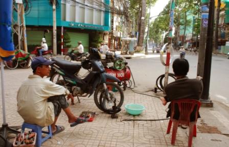
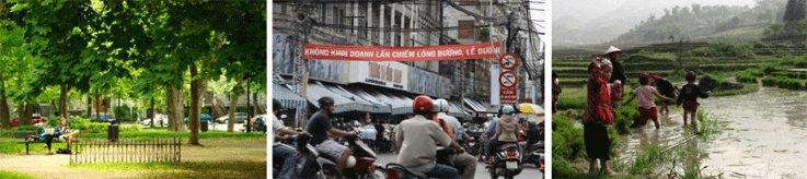
Post-doc (2011) INRS Centre Urbanisation Culture Société (Montréal) PhD (2009) Université de Sherbrooke, Dépt. de géomatique appliquée Msc (2004) Université de Sherbrooke, Dépt. de géomatique appliquée BA (2001) Université des sciences de Hanoi, Dépt. de géographie Ma recherche se penche sur les intéractions entre l'environnement naturel et les activities humaines dans différents milieux naturels et anthropiques. Je mets l'emphase sur la distribution spatiale de différents types d'utilisation du sol et d'occupation du sol, en recourant à des images de télédétection et d'autres données géographiques et socioéconomiques. Je m'intéresse particulièrement aux populations sujettes aux disparitiés dans l'accès aux ressources naturelles et/ou aménités et services. Mes sites d'études comprennent des villes, comme Montréal et Hanoi, ainsi que des milieux ruraux, comme des zones littorales dans le delta du fleuve Rouge ou des montagnes au bord de la frontière sino-vietnamienne. Articles avec comité de sélection Pham T-T-H., Apparicio P., Séguin A-M., S. Landry, Gagnon M. (2012 sous presse) Spatial distribution of vegetation in Montreal: An uneven distribution or environmental inequity? Landscape and Urban Planning. http://dx.doi.org/10.1016/j.landurbplan.2012.06.002 Pham T-T-H, He D-C (accepté) Optimaliser le choix de parameters de segmentation dans l’approche orrientée objets pour la classification du milieu urbain à partir d’une image Quickbird. Télédétection Pham T-T-H., He D-C, Morin D. (2012) Relationship between the landscape structure of urban green spaces and residents’ satisfaction: the case of a central district in Hanoi (Vietnam), Asian Journal of Geoinformatics 12 (1) (http://www.geoinfo.ait.ac.th/ajg/index.php/journal/article/view/35) Apparicio P., Séguin A-M., Pham T-T-H, Denis-Jacob J. (2012) What do we know about the provision of parks in our cities? A methodology for the classification of urban parks using GIS and remotely sensed data. Plan Canada 51 (4) p. 42-46 Pham T-T-H., Bonn F., Dubois J-M. (2007) Démarche méthodologique pour la détection des changements d’un milieu morcelé en utilisant des images à moyenne résolution spatiale : application à une région littorale au Viêt-nam. Télédétection 7(5) p. 302-323 Béland M., Goïta K., Bonn F. and Pham T-T-H. (2006) Assessment of land-cover changes related to shrimp aquaculture using remote sensing data: a case study in the Giao Thuy District, Vietnam. International Journal of Remote Sensing, 27 (8) p. 1491–1510
Chapitres de livres avec comité de sélection Pham T-T-H., Apparicio P., Séguin A-M., Gagnon M. (2011) Mapping the greenscape and environmental equity in Montreal: An application of Remote sensing and GIS. In Springer Lecture Notes in Geoinformation and Cartography - Mapping Environmental Issues in the City. Arts and Cartography Cross Perspectives. S. Caquard, L. Vaughan, W. Cartwright (Eds), p. 30-48 Actes de conférences avec comité de sélection Pham T-T-H., Apparicio P. (2010) Mapping urban green space in Montreal for better environmental justice: object-oriented classification of very-high-resolution images. Canadian Geomatics Conference 2010, Calgary, 14-18 June Pham T-T-H., He D-C. (2008) How do people perceive the city’s green space? A view from satellite imagery (in Hanoi, Vietnam). IEEE International Geoscience & Remote Sensing Symposium, Boston, July 2008 Pham T-T-H., Béland M., Bonn F., Goïta K., Dubois J-M. (2005) Assessment of land-cover changes related to shrimp farming in two districts of northern Vietnam using multitemporal Landsat data. Proceedings of the 25th Symposium of the EARSeL, Porto, July 2005. Global Developments in Environmental Earth Observation from Pham T-T-H., Bonn F., Dubois J-M. (2005) Détection des changements de l’occupation des terres par les images Landsat à Tien Hai (Viêt-Nam). Actes du 12e Congrès de l’AQT, Chicoutimi, May 2005, 8 p., CD ROM Travaux sans comité de sélection Pham T-T-H., Boudreau J-A., Collin J-P. (2011) Débats sur l’urbanisation au Viêt-Nam : Synthèse de la revue 'Người đô thị', 2007-2008. Working paper, no3-2011, INRS-UCS, Montréal, 110 p Pham T-T-H., Apparicio P., Weber C., Mathon D. (2010) Détection automatique des zones sinistrées à Port-au-Prince : l'approche orientée objet, une complémentarité opérationnelle à la photo-interprétation. Working paper, no7-2010, INRS-UCS, Montréal, 48 p Pham T-T-H., Apparicio P., Séguin A-M., Gagnon M. (2010) Végétation urbaine et injustice environnementale à Montréal : exploration du cas de trois arrondissements centraux à partir de l’imagerie satellitaire à très haute résolution spatiale, Working paper, no5-2010, INRS-UCS, Montréal, 48 p Conférences sans comité de sélection (depuis 2010) Pham T-T-H., Apparicio P., Séguin A-M, Landry S., Gagnon D. (2012) Disentangling street characteristics and the socioeconomic context underlying tree cover in Montreal using multilevel models, Annual Meeting of Association of American Geographers. New York, February 24-28 Pham, V. C., Pham T-T-H., Tong T. H. A., Pham T. H. (2011) Changes in agriculture landscape in the peri-urban of Hanoi: patterns in space and time. NASA-GOLC-GOLD-MAIRS Meeting on LULCC in Southeast Asia, Hanoi, November 5-11 Pham T-T-H., Apparicio P., Weber C., Mathon D. (2011). Comparaison de deux capteurs THRS pour la détection des dégâts causés par le séisme de Port-au-Prince. 79e Congrès de l’Association francophone pour le savoir, Sherbrooke, May 10 Pham T-T-H., Apparicio P., Séguin A-M, Gagnon M. (2011) Environmental justice and urban vegetation in Montréal: an application of object-based image analysis and GIS, Annual Meeting of Association of American Geographers, April 12-16 Apparicio P., Pham T-T-H., Cloutier M-S. (2011) Environmental justice and accessibility to parks for children in Montreal: Integration of GIS Data and very high resolution images, Annual Meeting of Association of American Geographers. Seattle, April 12-16 Pham T-T-H., Boudreau J-A., Collin J-P. (2010) Perceptions of environmental problems related to urbanization and climate change in Vietnam. Canadian Asian Studies Association, Ottawa, October 28-30 Pham T-T-H. (2010) What are the important indicators of urban life quality for local inhabitants? A case study of Hanoi. Annual Meeting of Association of American Geographers, Washington, April 14-18 Réseaux: Global Land Project; Int. Network of Research on Coupled Human-Natural Systems Données: Earth Explorer; E-STAT (Statistics Canada); TIGER (U.S. Census Bureau) Cartes: Strange Maps Blogs des expats au Viêt Nam: Antidote to Burnout; Our Man in Hanoi; Saigon Development and Construction |
|||